
Thank you for supporting this site ❤️
Make a donation
Make a donation
Gear up for your next adventure:
As an Amazon Associate, this site earns from qualifying purchases at no extra cost to you.
Medinipur topographic map
Click on the map to display elevation.
Thank you for supporting this site ❤️
Make a donation
Make a donation
Gear up for your next adventure:
As an Amazon Associate, this site earns from qualifying purchases at no extra cost to you.
About this map
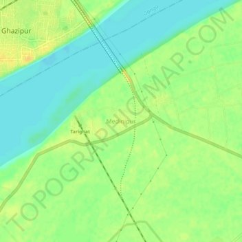
Name: Medinipur topographic map, elevation, terrain.
Location: Medinipur, Zamania, Ghazipur, Uttar Pradesh, 232336, India (25.55243 83.58961 25.59243 83.62961)
Average elevation: 65 m
Minimum elevation: 52 m
Maximum elevation: 77 m
Thank you for supporting this site ❤️
Make a donation
Make a donation
Gear up for your next adventure:
As an Amazon Associate, this site earns from qualifying purchases at no extra cost to you.