
Thank you for supporting this site ❤️
Make a donation
Make a donation
Gear up for your next adventure:
As an Amazon Associate, this site earns from qualifying purchases at no extra cost to you.
Moelfre topographic map
Click on the map to display elevation.
Thank you for supporting this site ❤️
Make a donation
Make a donation
Gear up for your next adventure:
As an Amazon Associate, this site earns from qualifying purchases at no extra cost to you.
About this map
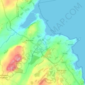
Name: Moelfre topographic map, elevation, terrain.
Location: Moelfre, Brynrefail, Isle of Anglesey, Wales, United Kingdom (53.33274 -4.32397 53.37766 -4.22741)
Average elevation: 43 m
Minimum elevation: 0 m
Maximum elevation: 170 m
Isle of Anglesey trails, hiking, mountain biking, running and outdoor activities
Thank you for supporting this site ❤️
Make a donation
Make a donation
Gear up for your next adventure:
As an Amazon Associate, this site earns from qualifying purchases at no extra cost to you.