
Bordj Badji Mokhtar topographic map
Interactive map
Click on the map to display elevation.
Bordj Badji Mokhtar
Bordj Badji Mokhtar is located at an elevation of 401 metres (1,316 ft) in the Tanezrouft, a desolate and mostly flat area in the Sahara Desert. The region is extremely sparsely populated with only four significant settlements in the Algerian part (the other three being Timiaouine, In Guezzam and Tin Zaouatine). Unlike most other towns in Saharan Algeria, Bordj Badji Mokhtar is not settled near an oasis but water is available from wells dug 400 metres (1,300 ft) underground.
About this map
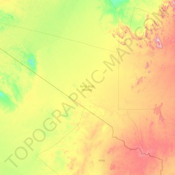
Name: Bordj Badji Mokhtar topographic map, elevation, terrain.
Location: Bordj Badji Mokhtar, Algeria (20.02838 -4.83333 25.24257 2.49875)
Average elevation: 383 m
Minimum elevation: 147 m
Maximum elevation: 1,272 m