
Putnam topographic map
Interactive map
Click on the map to display elevation.
About this map
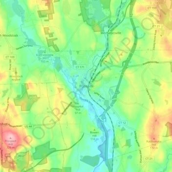
Name: Putnam topographic map, elevation, terrain.
Location: Putnam, Windham County, Connecticut, 06260, USA (41.87531 -71.94926 41.95531 -71.86926)
Average elevation: 118 m
Minimum elevation: 62 m
Maximum elevation: 215 m