
Thank you for supporting this site ❤️
Make a donation
Make a donation
Gear up for your next adventure:
As an Amazon Associate, this site earns from qualifying purchases at no extra cost to you.
Kipawa topographic map
Click on the map to display elevation.
Thank you for supporting this site ❤️
Make a donation
Make a donation
Gear up for your next adventure:
As an Amazon Associate, this site earns from qualifying purchases at no extra cost to you.
About this map
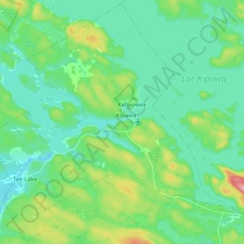
Name: Kipawa topographic map, elevation, terrain.
Location: Kipawa, Témiscamingue, Abitibi-Témiscamingue, Quebec, Canada (46.73109 -79.06435 46.82534 -78.92082)
Average elevation: 287 m
Minimum elevation: 245 m
Maximum elevation: 430 m
Thank you for supporting this site ❤️
Make a donation
Make a donation
Gear up for your next adventure:
As an Amazon Associate, this site earns from qualifying purchases at no extra cost to you.
Other topographic maps
Click on a map to view its topography, its elevation and its terrain.
Lac du Bois Franc
Canada > Quebec > Témiscamingue > Les Lacs-du-Témiscamingue
Average elevation: 398 m