
Burgettstown topographic map
Interactive map
Click on the map to display elevation.
About this map
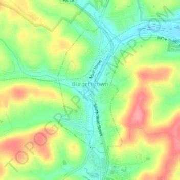
Name: Burgettstown topographic map, elevation, terrain.
Average elevation: 331 m
Minimum elevation: 290 m
Maximum elevation: 381 m
Other topographic maps
Click on a map to view its topography, its elevation and its terrain.
Strabane
États-Unis d'Amérique > Pennsylvanie > Washington County > North Strabane Township > Strabane
Strabane, North Strabane Township, Washington County, Pennsylvanie, 15363, États-Unis d'Amérique
Average elevation: 329 m
Manifold
États-Unis d'Amérique > Pennsylvanie > Washington County > South Strabane Township
Manifold, South Strabane Township, Washington County, Pennsylvanie, 15347, États-Unis d'Amérique
Average elevation: 354 m