
Geita topographic map
Interactive map
Click on the map to display elevation.
About this map
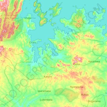
Name: Geita topographic map, elevation, terrain.
Location: Geita, Lake Zone, Tanzania (-3.32937 31.77448 -2.18622 32.52110)
Average elevation: 1,218 m
Minimum elevation: 1,130 m
Maximum elevation: 1,628 m
Other topographic maps
Click on a map to view its topography, its elevation and its terrain.