Geolocate

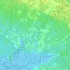
Sea Isle Junction topographic map

Click on the map to display elevation.

About this map

Name: Sea Isle Junction topographic map, elevation, terrain.

Location: Sea Isle Junction, Dennis Township, Cape May County, New Jersey, 08230, United States (39.18515 -74.77012 39.20515 -74.75012)

Average elevation: 7 m

Minimum elevation: 1 m

Maximum elevation: 11 m

Other topographic maps

Click on a map to view its topography, its elevation and its terrain.
Gear up for your next adventure:

🍲Portable Camping Stoves - Fast-boiling stoves for hot meals on remote topographic survey trips
🥤Hiking Water Bottles - Reusable bottles for hydration on the trail
🥼Base Layers - Thermal base layers for temperature regulation
🧗Locking Carabiners - Secure gear to your pack or for light technical use
🥾Women's Waterproof Hiking Boots - High-performance trekking boots designed for all-weather comfort

As an Amazon Associate, this site earns from qualifying purchases at no extra cost to you.