Geolocate

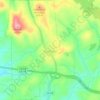
Archville topographic map

Click on the map to display elevation.

About this map

Name: Archville topographic map, elevation, terrain.

Location: Archville, Polk County, East Tennessee, Tennessee, United States (35.11285 -84.54549 35.15285 -84.50549)

Average elevation: 384 m

Minimum elevation: 281 m

Maximum elevation: 634 m

Other topographic maps

Click on a map to view its topography, its elevation and its terrain.
Copperhill

United States > Tennessee > Polk County

Average elevation: 494 m

Ducktown

United States > Tennessee > Polk County

Average elevation: 514 m

Benton

United States > Tennessee > Polk County

Average elevation: 243 m

Copperhill

United States > Tennessee > Polk County

Average elevation: 493 m

Ducktown

United States > Tennessee > Polk County

Average elevation: 514 m

Gear up for your next adventure:

📱Rugged Phone Cases - Heavy-duty protection for smartphones used as secondary GPS tools
👖Packable Overtrousers - Quick-deploy rain protection for legs in sudden storms
🎒Hiking Child Carriers - Explore the outdoors with the whole family safely
🔪Outdoor Multi-Tools - Versatile tools for gear repairs and food prep in the wild
🦯Walking Poles - Supportive poles for long-distance walking

As an Amazon Associate, this site earns from qualifying purchases at no extra cost to you.