
Wiehl topographic map
Interactive map
Click on the map to display elevation.
About this map
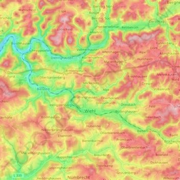
Name: Wiehl topographic map, elevation, terrain.
Average elevation: 264 m
Minimum elevation: 137 m
Maximum elevation: 376 m
Other topographic maps
Click on a map to view its topography, its elevation and its terrain.
Hahn
Germany > North Rhine-Westphalia > Oberbergischer Kreis > Wiehl > Brächen
Hahn, Brächen, Wiehl, Oberbergischer Kreis, North Rhine-Westphalia, 51674, Germany
Average elevation: 277 m