Geolocate

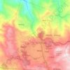
Alno topographic map

Click on the map to display elevation.

About this map

Name: Alno topographic map, elevation, terrain.

Location: Alno, La Trinidad, Benguet, Cordillera Administrative Region, 2601, Philippines (16.46635 120.57491 16.50635 120.61491)

Average elevation: 1,013 m

Minimum elevation: 565 m

Maximum elevation: 1,414 m

Other topographic maps

Click on a map to view its topography, its elevation and its terrain.
Bolo Creek

Philippines > Benguet > La Trinidad > Cabanao

Average elevation: 1,313 m

Balili River

Philippines > Benguet > La Trinidad > Cruz

Average elevation: 1,196 m

Bolo Creek

Philippines > Benguet > La Trinidad > Cruz > Central Buyagan

Average elevation: 1,321 m

Gear up for your next adventure:

🎒Hiking Backpacks - Comfortable backpacks for day hikes and multi-day treks
🧣Neck Gaiters - Protects against wind and sun on exposed ridges and peaks
📱Phone Mounts for Hiking - Secure mounts to carry your phone on trails
🧘Folding Sit Mats - Dry and warm seat for map-reading breaks on damp ground
📷Outdoor Action Cameras - Cameras designed for hiking and adventure

As an Amazon Associate, this site earns from qualifying purchases at no extra cost to you.