
Illecillewaet Glacier topographic map
Interactive map
Click on the map to display elevation.
About this map
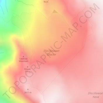
Name: Illecillewaet Glacier topographic map, elevation, terrain.
Average elevation: 2,414 m
Minimum elevation: 1,768 m
Maximum elevation: 2,664 m
Other topographic maps
Click on a map to view its topography, its elevation and its terrain.
Heart Lake
Canada > British Columbia > Columbia-Shuswap Regional District > Area B (Shelter Bay/Mica Creek)
Average elevation: 1,968 m
Mount Revelstoke
Canada > British Columbia > Columbia-Shuswap Regional District > Area B (Shelter Bay/Mica Creek)
Average elevation: 1,730 m