
Kakoola topographic map
Interactive map
Click on the map to display elevation.
About this map
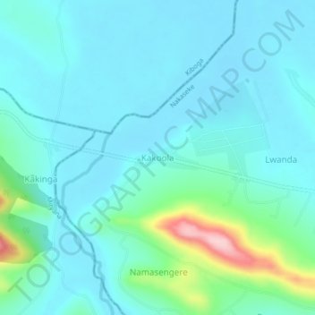
Name: Kakoola topographic map, elevation, terrain.
Location: Kakoola, Nakaseke, Central Region, Uganda (0.66140 32.15892 0.70140 32.19892)
Average elevation: 1,113 m
Minimum elevation: 1,076 m
Maximum elevation: 1,302 m