
Thank you for supporting this site ❤️
Make a donation
Make a donation
Gear up for your next adventure:
As an Amazon Associate, this site earns from qualifying purchases at no extra cost to you.
Kinole topographic map
Click on the map to display elevation.
Thank you for supporting this site ❤️
Make a donation
Make a donation
Gear up for your next adventure:
As an Amazon Associate, this site earns from qualifying purchases at no extra cost to you.
About this map
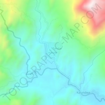
Name: Kinole topographic map, elevation, terrain.
Location: Kinole, Morogoro, Morogoro Region, Coastal Zone, Tanzania (-6.93097 37.73911 -6.89097 37.77911)
Average elevation: 629 m
Minimum elevation: 418 m
Maximum elevation: 1,276 m
Thank you for supporting this site ❤️
Make a donation
Make a donation
Gear up for your next adventure:
As an Amazon Associate, this site earns from qualifying purchases at no extra cost to you.