Geolocate

Cananea topographic map

Click on the map to display elevation.

About this map

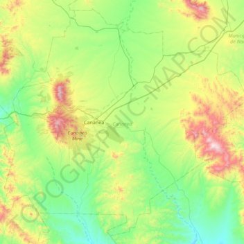
Name: Cananea topographic map, elevation, terrain.

Location: Cananea, Sonora, 84620, Mexico (30.71552 -110.54017 31.25747 -109.86181)

Average elevation: 1,500 m

Minimum elevation: 1,096 m

Maximum elevation: 2,608 m

Gear up for your next adventure:

🦟Anti-Midge & Tick Repellent - Vital for hiking in the Scottish Highlands during summer
📻Hand-Crank Emergency Radios - Stay updated on weather warnings in remote areas
🦯Walking Poles - Supportive poles for long-distance walking
🛑Emergency Bivvy Bags - Heat-reflective survival bags for unexpected nights out
📷Camera Straps - Secure straps for carrying cameras while walking

As an Amazon Associate, this site earns from qualifying purchases at no extra cost to you.