
Lavanghe topographic map
Interactive map
Click on the map to display elevation.
About this map
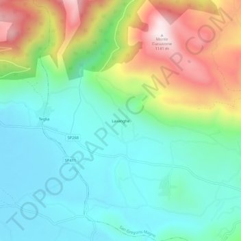
Name: Lavanghe topographic map, elevation, terrain.
Location: Lavanghe, San Gregorio Magno, Salerno, Campania, 84021, Italia (40.65229 15.34445 40.69229 15.38445)
Average elevation: 655 m
Minimum elevation: 432 m
Maximum elevation: 1,136 m