
Rosières topographic map
Interactive map
Click on the map to display elevation.
About this map
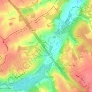
Name: Rosières topographic map, elevation, terrain.
Average elevation: 76 m
Minimum elevation: 35 m
Maximum elevation: 107 m
Other topographic maps
Click on a map to view its topography, its elevation and its terrain.
Genval
Belgique > Brabant wallon > Nivelles > Rixensart
Genval, Rixensart, Nivelles, Brabant wallon, Wallonie, 1332, Belgique
Average elevation: 82 m