
Caladroi topographic map
Interactive map
Click on the map to display elevation.
About this map
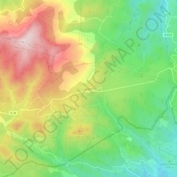
Name: Caladroi topographic map, elevation, terrain.
Average elevation: 304 m
Minimum elevation: 120 m
Maximum elevation: 535 m
Other topographic maps
Click on a map to view its topography, its elevation and its terrain.
Dolmen du Moulin à Vent (B)
France > Occitanie > Pyrénées-Orientales > Bélesta
Dolmen du Moulin à Vent (B), D 17, Bélesta, Prades, Pyrénées-Orientales, Occitanie, France métropolitaine, 66720, France
Average elevation: 372 m