
Fujairah topographic map
Interactive map
Click on the map to display elevation.
About this map
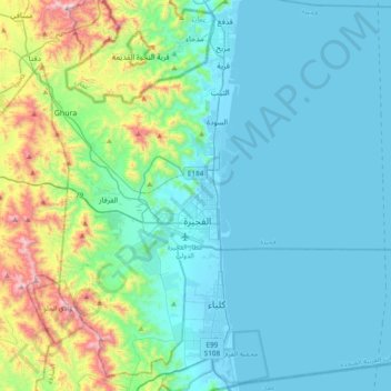
Name: Fujairah topographic map, elevation, terrain.
Location: Fujairah, United Arab Emirates (24.97448 56.15316 25.31752 56.37592)
Average elevation: 192 m
Minimum elevation: -4 m
Maximum elevation: 1,097 m
Other topographic maps
Click on a map to view its topography, its elevation and its terrain.