Geolocate

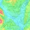
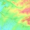
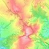
Trimpley Green topographic map

Click on the map to display elevation.

About this map

Name: Trimpley Green topographic map, elevation, terrain.

Location: Trimpley Green, Kidderminster Foreign, Wyre Forest, Worcestershire, England, United Kingdom (52.39953 -2.30576 52.40261 -2.29983)

Average elevation: 113 m

Minimum elevation: 21 m

Maximum elevation: 191 m

Worcestershire trails, hiking, mountain biking, running and outdoor activities

Other topographic maps

Click on a map to view its topography, its elevation and its terrain.
Wilden

United Kingdom > England > Worcestershire > Wyre Forest

Average elevation: 45 m

Bewdley

United Kingdom > England > Worcestershire > Wyre Forest

Average elevation: 75 m

Rock

United Kingdom > England > Worcestershire > Wyre Forest

Average elevation: 133 m

Cookley

United Kingdom > England > Worcestershire > Wyre Forest

Average elevation: 70 m

Broome

United Kingdom > England > Worcestershire > Wyre Forest

Average elevation: 108 m

Hoobrook

United Kingdom > England > Worcestershire > Wyre Forest

Average elevation: 53 m

Clows Top

United Kingdom > England > Worcestershire > Wyre Forest

Average elevation: 176 m

Bewdley

United Kingdom > England > Worcestershire > Wyre Forest

Average elevation: 75 m

Gear up for your next adventure:

🧺Ultralight Dry Bags - Organize and waterproof your gear inside your rucksack
🧭GPS Trackers - Tracking devices for safety and navigation
🔋Power Banks - Portable chargers for long outdoor trips
📱Phone Mounts for Hiking - Secure mounts to carry your phone on trails
📍Handheld GPS Navigators - Reliable satellite navigation for hiking and off-road exploration

As an Amazon Associate, this site earns from qualifying purchases at no extra cost to you.