
Thank you for supporting this site ❤️
Make a donation
Make a donation
Gear up for your next adventure:
As an Amazon Associate, this site earns from qualifying purchases at no extra cost to you.
Mulas topographic map
Click on the map to display elevation.
Thank you for supporting this site ❤️
Make a donation
Make a donation
Gear up for your next adventure:
As an Amazon Associate, this site earns from qualifying purchases at no extra cost to you.
About this map
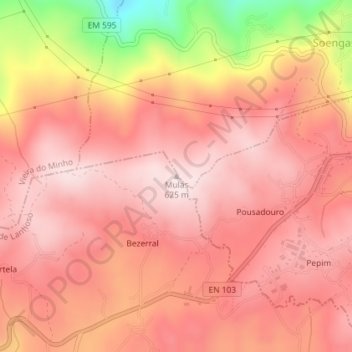
Name: Mulas topographic map, elevation, terrain.
Location: Mulas, Póvoa de Lanhoso, Braga, 4850-503, Portugal (41.63275 -8.21145 41.63285 -8.21135)
Average elevation: 499 m
Minimum elevation: 190 m
Maximum elevation: 619 m
Thank you for supporting this site ❤️
Make a donation
Make a donation
Gear up for your next adventure:
As an Amazon Associate, this site earns from qualifying purchases at no extra cost to you.