
Ambohimahasoa topographic map
Interactive map
Click on the map to display elevation.
About this map
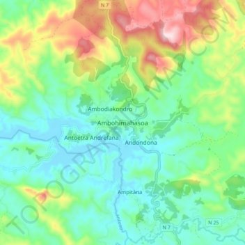
Name: Ambohimahasoa topographic map, elevation, terrain.
Average elevation: 1,267 m
Minimum elevation: 1,138 m
Maximum elevation: 1,561 m
Other topographic maps
Click on a map to view its topography, its elevation and its terrain.
Ampanidinana
Madagascar > Haute Matsiatra > Ambohimahasoa
Ampanidinana, Ambohimahasoa, Haute Matsiatra, Province de Fianarantsoa, Madagascar
Average elevation: 1,329 m