Geolocate

Guimba topographic map

Click on the map to display elevation.

About this map

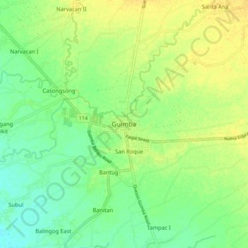
Name: Guimba topographic map, elevation, terrain.

Location: Guimba, Nueva Ecija, Central Luzon, 3115, Philippines (15.62035 120.72691 15.70035 120.80691)

Average elevation: 35 m

Minimum elevation: 23 m

Maximum elevation: 45 m

Gear up for your next adventure:

🎒Hiking Daypacks - Compact backpacks ideal for short hikes and excursions
📻Hand-Crank Emergency Radios - Stay updated on weather warnings in remote areas
🧥Packable Down Jackets - Lightweight warmth that compresses small in your bag
🛰️Handheld GPS Devices - Reliable GPS units for hiking and outdoor navigation
🔪Outdoor Multi-Tools - Versatile tools for gear repairs and food prep in the wild

As an Amazon Associate, this site earns from qualifying purchases at no extra cost to you.