Geolocate

Marianna topographic map

Click on the map to display elevation.

About this map
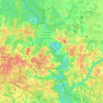
Name: Marianna topographic map, elevation, terrain.

Location: Marianna, Jackson County, Florida, 32447, United States (30.73335 -85.28417 30.85586 -85.16404)

Average elevation: 39 m

Minimum elevation: 15 m

Maximum elevation: 67 m

Other topographic maps

Click on a map to view its topography, its elevation and its terrain.

Compass Lake

United States > Florida > Jackson County

Average elevation: 66 m

Shady Grove

United States > Florida > Jackson County

Average elevation: 49 m

Compass Lake

United States > Florida > Jackson County

Average elevation: 66 m

Gear up for your next adventure:

🛰️Handheld GPS Devices - Reliable GPS units for hiking and outdoor navigation
🧼Technical Clothing Wash - Special soap to clean and restore waterproof membranes
🛌Sleeping Mats - Insulated mats for comfortable outdoor sleeping
📷Outdoor Action Cameras - Cameras designed for hiking and adventure
🛰️Satellite Messengers - Emergency communication devices for areas without mobile signal

As an Amazon Associate, this site earns from qualifying purchases at no extra cost to you.