
Thank you for supporting this site ❤️
Make a donation
Make a donation
Gear up for your next adventure:
As an Amazon Associate, this site earns from qualifying purchases at no extra cost to you.
Wadi Tanuf topographic map
Click on the map to display elevation.
Thank you for supporting this site ❤️
Make a donation
Make a donation
Gear up for your next adventure:
As an Amazon Associate, this site earns from qualifying purchases at no extra cost to you.
About this map
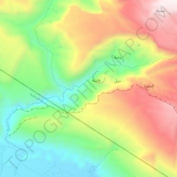
Name: Wadi Tanuf topographic map, elevation, terrain.
Location: Wadi Tanuf, Qashah, Al Batinah South Governorate, Oman (23.06163 57.46841 23.09127 57.55103)
Average elevation: 1,260 m
Minimum elevation: 585 m
Maximum elevation: 2,207 m
Thank you for supporting this site ❤️
Make a donation
Make a donation
Gear up for your next adventure:
As an Amazon Associate, this site earns from qualifying purchases at no extra cost to you.