Geolocate

Sersa topographic map

Click on the map to display elevation.

About this map

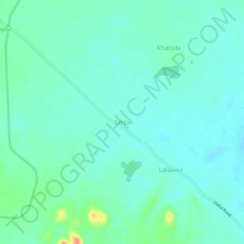
Name: Sersa topographic map, elevation, terrain.

Location: Sersa, Datia Tahsil, Datia, Madhya Pradesh, India (25.60026 78.52141 25.64026 78.56141)

Average elevation: 229 m

Minimum elevation: 215 m

Maximum elevation: 283 m

Other topographic maps

Click on a map to view its topography, its elevation and its terrain.

Rajapur

India > Madhya Pradesh > Datia Tahsil

Average elevation: 278 m

Gear up for your next adventure:

📍Handheld GPS Navigators - Reliable satellite navigation for hiking and off-road exploration
🛰️Handheld GPS Devices - Reliable GPS units for hiking and outdoor navigation
🔦LED Camping Lanterns - Illumination for reading maps inside your tent at night
🎒Hiking Daypacks - Compact backpacks ideal for short hikes and excursions
📦Compression Sacks - Reduce backpack volume efficiently

As an Amazon Associate, this site earns from qualifying purchases at no extra cost to you.