Geolocate

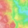
Box Elder Hutterite Colony topographic map

Click on the map to display elevation.

About this map

Name: Box Elder Hutterite Colony topographic map, elevation, terrain.

Location: Box Elder Hutterite Colony, Maple Creek No. 111, Saskatchewan, Canada (49.76908 -109.90832 49.80908 -109.86832)

Average elevation: 948 m

Minimum elevation: 905 m

Maximum elevation: 988 m

Other topographic maps

Click on a map to view its topography, its elevation and its terrain.
Loch Leven

Canada > Saskatchewan > Maple Creek No. 111

Average elevation: 1,227 m

Gear up for your next adventure:

🌂Windproof Trekking Umbrellas - Surprising but effective rain protection on low-wind trails
🧥Packable Down Jackets - Lightweight warmth that compresses small in your bag
📷Camera Straps - Secure straps for carrying cameras while walking
🦟Anti-Midge & Tick Repellent - Vital for hiking in the Scottish Highlands during summer
👖Hiking Trousers - Durable trousers designed for rough terrain

As an Amazon Associate, this site earns from qualifying purchases at no extra cost to you.