
Bishampton topographic map
Click on the map to display elevation.
About this map
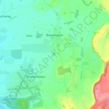
Name: Bishampton topographic map, elevation, terrain.
Location: Bishampton, Wychavon, Worcestershire, England, United Kingdom (52.13902 -2.05324 52.17062 -1.98306)
Average elevation: 44 m
Minimum elevation: 18 m
Maximum elevation: 114 m
Worcestershire trails, hiking, mountain biking, running and outdoor activities
Other topographic maps
Click on a map to view its topography, its elevation and its terrain.
Atch Lench
United Kingdom > England > Worcestershire > Wychavon > Church Lench
Average elevation: 80 m
Badsey Lane Nature Reserve
United Kingdom > England > Worcestershire > Wychavon > Evesham
Average elevation: 37 m