Prato topographic map
Click on the map to display elevation.
Prato
Prato (/ˈprɑːtoʊ/ PRAH-toh; Italian: [ˈpraːto] ) is a city and comune (municipality) in the region of Tuscany in Italy, and is the capital of the Province of Prato. The city lies in the northeast of Tuscany, at an elevation of 65 metres (213 ft), at the foot of Monte Retaia (the last peak in the Calvana chain). The distance between Prato and Florence is approximately 15–17 kilometers (about 9–10 miles). With a population of 198,327 as of 2026, Prato is Tuscany's 2nd-largest city after Florence, and the 18th-largest in Italy.
About this map
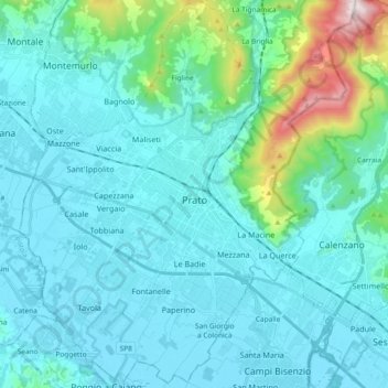
Name: Prato topographic map, elevation, terrain.
Location: Prato, Tuscany, 59100, Italy (43.81576 11.01317 43.94948 11.16961)
Average elevation: 148 m
Minimum elevation: 31 m
Maximum elevation: 916 m
Other topographic maps
Click on a map to view its topography, its elevation and its terrain.