Geolocate

Baker topographic map

Click on the map to display elevation.

About this map

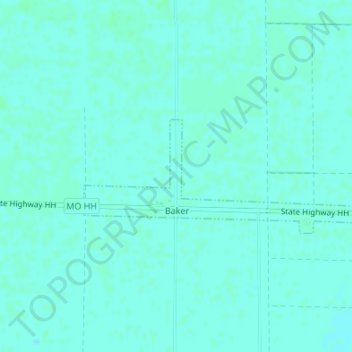
Name: Baker topographic map, elevation, terrain.

Location: Baker, Stoddard County, Missouri, United States (36.77109 -89.77318 36.77984 -89.74603)

Average elevation: 89 m

Minimum elevation: 87 m

Maximum elevation: 91 m

Other topographic maps

Click on a map to view its topography, its elevation and its terrain.

Shawan

United States > Missouri > Stoddard County

Average elevation: 94 m

Tillman

United States > Missouri > Stoddard County

Average elevation: 123 m

Gear up for your next adventure:

🧤Thermal Touchscreen Gloves - Stay warm while operating your GPS or smartphone camera
📱Phone Mounts for Hiking - Secure mounts to carry your phone on trails
🪓Outdoor Multitools - Versatile tools for hiking and camping
🥤Collapsible Water Bottles - Save space in your rucksack as you consume your water
👟Heavy Duty Boot Laces - Always carry a spare for your hiking footwear

As an Amazon Associate, this site earns from qualifying purchases at no extra cost to you.