Geolocate

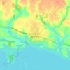
Lamarche topographic map

Click on the map to display elevation.

About this map

Name: Lamarche topographic map, elevation, terrain.

Location: Lamarche, Lac-Saint-Jean-Est, Saguenay–Lac-Saint-Jean, Québec, G0W 1X0, Canada (48.74049 -71.55088 48.84949 -71.32153)

Average elevation: 249 m

Minimum elevation: 168 m

Maximum elevation: 643 m

Other topographic maps

Click on a map to view its topography, its elevation and its terrain.

Lac Vert

Canada > Québec > Lac-Saint-Jean-Est > Hébertville

Average elevation: 177 m

Lac Savane

Canada > Québec > Lac-Saint-Jean-Est > Lamarche

Average elevation: 218 m

Lac Sophie

Canada > Québec > Lac-Saint-Jean-Est > Alma > L'Île-d'Alma

Average elevation: 109 m

Lac Barnabé

Canada > Québec > Lac-Saint-Jean-Est > Hébertville

Average elevation: 410 m

Grande-Décharge

Canada > Québec > Lac-Saint-Jean-Est > Alma

Average elevation: 107 m

La Savane

Canada > Québec > Lac-Saint-Jean-Est > Labrecque

Average elevation: 183 m

Saint-Coeur-de-Marie

Canada > Québec > Lac-Saint-Jean-Est > Alma

Average elevation: 110 m

Saint-Coeur-de-Marie

Canada > Québec > Lac-Saint-Jean-Est > Alma

Average elevation: 110 m

Gear up for your next adventure:

🐕Dog Hiking Gear - Equipment for hiking safely with dogs
🥾Women's Waterproof Hiking Boots - High-performance trekking boots designed for all-weather comfort
🛰️Outdoor GPS Navigation - Navigation devices for remote and off-grid areas
🎿Telescopic Trekking Poles - Reduces knee strain on steep topographic descents
🧴Sport Sunscreen Sticks - High-protection sunblock that won't run into your eyes on the trail

As an Amazon Associate, this site earns from qualifying purchases at no extra cost to you.