Geolocate

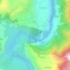
Ropa topographic map

Click on the map to display elevation.

About this map

Name: Ropa topographic map, elevation, terrain.

Location: Ropa, Sundarnagar, Mandi, Himachal Pradesh, 174401, India (31.52060 76.87458 31.56060 76.91458)

Average elevation: 892 m

Minimum elevation: 806 m

Maximum elevation: 1,325 m

Other topographic maps

Click on a map to view its topography, its elevation and its terrain.
Koldam Dam

India > Himachal Pradesh > Sundarnagar > Bilaspur > Ropa

Average elevation: 734 m

Gear up for your next adventure:

🐕Dog Hiking Gear - Equipment for hiking safely with dogs
👟Waterproof Leg Gaiters - Keep mud and water out of your boots in boggy terrain
🍲Portable Camping Stoves - Fast-boiling stoves for hot meals on remote topographic survey trips
👖Packable Overtrousers - Quick-deploy rain protection for legs in sudden storms
🦶Anti-Blister Balms - Protect your feet before long topographic expeditions

As an Amazon Associate, this site earns from qualifying purchases at no extra cost to you.