Geolocate

Daru topographic map

Click on the map to display elevation.

About this map
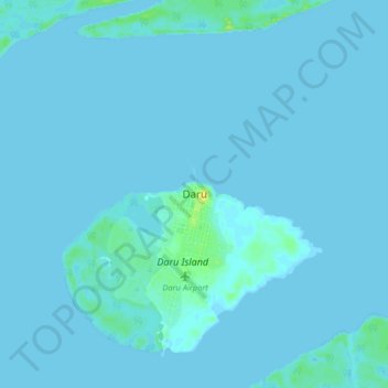
Name: Daru topographic map, elevation, terrain.

Location: Daru, South Fly District, Western, Southern Region, 331, Papua New Guinea (-9.22990 143.05003 -8.90990 143.37003)

Average elevation: 3 m

Minimum elevation: -3 m

Maximum elevation: 42 m

Other topographic maps

Click on a map to view its topography, its elevation and its terrain.

Tabubil

Papua New Guinea > Western

Average elevation: 591 m

Tabubil

Papua New Guinea > Western

Average elevation: 591 m

Ok Menga

Papua New Guinea > Western > Migalsimbip

Average elevation: 574 m

Gear up for your next adventure:

🍱Food Containers - Reusable containers for outdoor meals
🗺️Ordnance Survey Maps - Essential paper maps for hiking across the UK national parks
🔦Waterproof LED Headlamps - Hands-free lighting for evening treks and emergency navigation
🔥Reusable Hand Warmers - Maintain dexterity in your fingers for precise map handling
📦Dry Bags - Waterproof bags to protect gear from rain

As an Amazon Associate, this site earns from qualifying purchases at no extra cost to you.