
Lauben topographic map
Interactive map
Click on the map to display elevation.
About this map
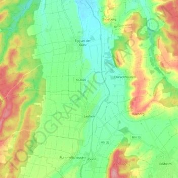
Name: Lauben topographic map, elevation, terrain.
Average elevation: 602 m
Minimum elevation: 558 m
Maximum elevation: 671 m
Other topographic maps
Click on a map to view its topography, its elevation and its terrain.
Unggenried
Germany > Bavaria > Landkreis Unterallgäu > Mindelheim
Unggenried, Mindelheim, Landkreis Unterallgäu, Bavaria, 87719, Germany
Average elevation: 623 m
Markt Rettenbach
Germany > Bavaria > Landkreis Unterallgäu
Markt Rettenbach, Landkreis Unterallgäu, Bavaria, 87733, Germany
Average elevation: 702 m
Böhen
Germany > Bavaria > Landkreis Unterallgäu
Böhen, Ottobeuren, Landkreis Unterallgäu, Bavaria, 87736, Germany
Average elevation: 745 m