
Hato Grande topographic map
Interactive map
Click on the map to display elevation.
About this map
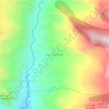
Name: Hato Grande topographic map, elevation, terrain.
Location: Hato Grande, Cundinamarca, Gachetá, Colombia (4.78873 -73.60118 4.82873 -73.56118)
Average elevation: 2,034 m
Minimum elevation: 1,637 m
Maximum elevation: 2,575 m