
Gotartowice topographic map
Interactive map
Click on the map to display elevation.
About this map
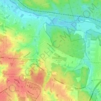
Name: Gotartowice topographic map, elevation, terrain.
Location: Gotartowice, Rybnik, Silesian Voivodeship, RYBNIK, Poland (50.05861 18.59703 50.08850 18.65684)
Average elevation: 253 m
Minimum elevation: 226 m
Maximum elevation: 284 m