
Linares topographic map
Interactive map
Click on the map to display elevation.
About this map
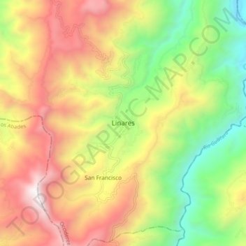
Name: Linares topographic map, elevation, terrain.
Location: Linares, Occidente, Nariño, Colombia (1.31165 -77.56352 1.39165 -77.48352)
Average elevation: 1,679 m
Minimum elevation: 723 m
Maximum elevation: 2,735 m
Other topographic maps
Click on a map to view its topography, its elevation and its terrain.
La Arboleda
Colombia > Nariño > Linares > Linares > La Arboleda
La Arboleda, Linares, Occidente, Nariño, Colombia
Average elevation: 1,852 m