Geolocate

Villasis topographic map

Click on the map to display elevation.

About this map

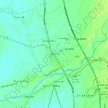
Name: Villasis topographic map, elevation, terrain.

Location: Villasis, Pangasinan, Ilocos Region, 2441, Philippines (15.86159 120.54831 15.94159 120.62831)

Average elevation: 27 m

Minimum elevation: 20 m

Maximum elevation: 39 m

Gear up for your next adventure:

🥾Men's Waterproof Hiking Boots - Durable footwear with deep lugs for muddy and rocky UK terrains
🚲Cycling GPS Computers - Track elevation and topographic routes on two wheels
🎒Multi-day Trekking Packs - Large capacity backpacks for wild camping and long-distance trails
🛰️Outdoor GPS Navigation - Navigation devices for remote and off-grid areas
🧴Sport Sunscreen Sticks - High-protection sunblock that won't run into your eyes on the trail

As an Amazon Associate, this site earns from qualifying purchases at no extra cost to you.