
Kandanghaur topographic map
Interactive map
Click on the map to display elevation.
About this map
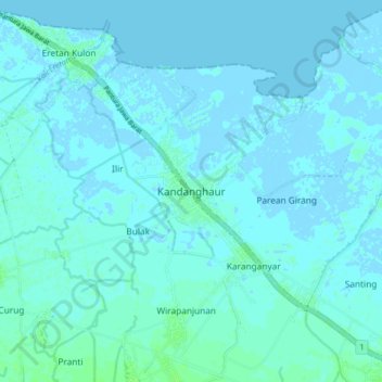
Name: Kandanghaur topographic map, elevation, terrain.
Location: Kandanghaur, Indramayu Regency, West Java, Indonesia (-6.39468 108.06629 -6.31468 108.14629)
Average elevation: 2 m
Minimum elevation: -4 m
Maximum elevation: 7 m