
El Cerrillo Piedras Blancas topographic map
Interactive map
Click on the map to display elevation.
About this map
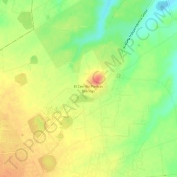
Name: El Cerrillo Piedras Blancas topographic map, elevation, terrain.
Location: El Cerrillo Piedras Blancas, Toluca, 50295, México (19.39432 -99.70125 19.43432 -99.66125)
Average elevation: 2,596 m
Minimum elevation: 2,568 m
Maximum elevation: 2,619 m
Other topographic maps
Click on a map to view its topography, its elevation and its terrain.
San Nicolas Tolentino
San Nicolas Tolentino, Toluca, 50210, México
Average elevation: 2,584 m
San Mateo Otzacatipan
San Mateo Otzacatipan, Toluca, 50228, México
Average elevation: 2,598 m
Santiago Tlacotepec
Santiago Tlacotepec, Toluca, 50240, México
Average elevation: 2,800 m
San Andres Coexcotitlan
San Andres Coexcotitlan, Toluca, 50200, México
Average elevation: 2,600 m