
Ramoute topographic map
Interactive map
Click on the map to display elevation.
About this map
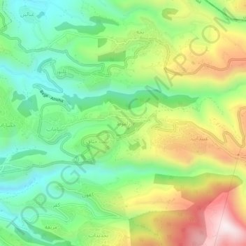
Name: Ramoute topographic map, elevation, terrain.
Location: Ramoute, Jbeil District, Mount Lebanon Governorate, Lebanon (34.14657 35.69197 34.18657 35.73197)
Average elevation: 536 m
Minimum elevation: 276 m
Maximum elevation: 946 m