
Sainte-Louise topographic map
Interactive map
Click on the map to display elevation.
About this map
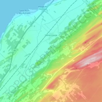
Name: Sainte-Louise topographic map, elevation, terrain.
Location: Sainte-Louise, L'Islet, Chaudière-Appalaches, Québec, Canada (47.20589 -70.18146 47.32312 -70.00312)
Average elevation: 134 m
Minimum elevation: 0 m
Maximum elevation: 482 m