
Pevely topographic map
Interactive map
Click on the map to display elevation.
About this map
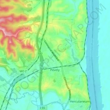
Name: Pevely topographic map, elevation, terrain.
Average elevation: 148 m
Minimum elevation: 109 m
Maximum elevation: 250 m
Other topographic maps
Click on a map to view its topography, its elevation and its terrain.
Pevely
États-Unis d'Amérique > Missouri > Jefferson County > Pevely > Pevely
Pevely, Jefferson County, Missouri, 63050:63070, États-Unis d'Amérique
Average elevation: 145 m