Geolocate

Achhnera topographic map

Click on the map to display elevation.

About this map

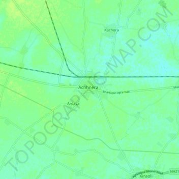
Name: Achhnera topographic map, elevation, terrain.

Location: Achhnera, Kiraoli, Agra, Uttar Pradesh, India (27.13715 77.71751 27.21715 77.79751)

Average elevation: 172 m

Minimum elevation: 167 m

Maximum elevation: 177 m

Gear up for your next adventure:

🚶Walking Pedometers - Simple distance tracking for casual trail walkers
🔋Solar Chargers - Eco-friendly charging solutions for outdoor use
🧺Microfibre Travel Towels - Fast-drying and compact towels for wild swimming and camping
🗺️Ordnance Survey Maps - Official UK maps for walking and outdoor activities
GPS Outdoor Watches - Watches with GPS tracking for hiking and exploration

As an Amazon Associate, this site earns from qualifying purchases at no extra cost to you.