
Hartland Township topographic map
Interactive map
Click on the map to display elevation.
About this map
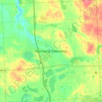
Name: Hartland Township topographic map, elevation, terrain.
Average elevation: 304 m
Minimum elevation: 272 m
Maximum elevation: 352 m
Other topographic maps
Click on a map to view its topography, its elevation and its terrain.
Howell
United States > Michigan > Livingston County
Howell, Livingston County, Michigan, United States
Average elevation: 282 m
Whitmore Lake
United States > Michigan > Livingston County > Green Oak Township > Whitmore Lake
Whitmore Lake, Green Oak Township, Livingston County, Michigan, 48189, United States
Average elevation: 276 m
Hamburg Township
United States > Michigan > Livingston County
Hamburg Township, Livingston County, Michigan, United States
Average elevation: 275 m
Hell
United States > Michigan > Livingston County > Putnam Township
Hell, Putnam Township, Livingston County, Michigan, United States
Average elevation: 277 m