
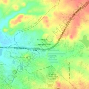
Maheshwaram topographic map
Interactive map
Click on the map to display elevation.
About this map
Name: Maheshwaram topographic map, elevation, terrain.
Average elevation: 589 m
Minimum elevation: 560 m
Maximum elevation: 619 m
Other topographic maps
Click on a map to view its topography, its elevation and its terrain.
Dundigal
India > Telangana > Dundigal_Gandimaisamma mandal
Dundigal, Dundigal_Gandimaisamma mandal, Medchal–Malkajgiri District, Telangana, 500043, India
Average elevation: 608 m