
Peñaverde topographic map
Interactive map
Click on the map to display elevation.
About this map
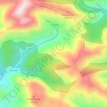
Name: Peñaverde topographic map, elevation, terrain.
Location: Peñaverde, Gustevela, Cangas de Onís, Astúrias, Espanha (43.37657 -5.02903 43.39657 -5.00903)
Average elevation: 438 m
Minimum elevation: 183 m
Maximum elevation: 717 m