
Fontanella topographic map
Interactive map
Click on the map to display elevation.
About this map
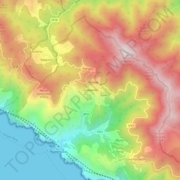
Name: Fontanella topographic map, elevation, terrain.
Location: Fontanella, Vernazza, La Spezia, Ligurie, 19018, Italie (44.12796 9.67361 44.16796 9.71361)
Average elevation: 408 m
Minimum elevation: 0 m
Maximum elevation: 801 m
Other topographic maps
Click on a map to view its topography, its elevation and its terrain.
Cinque Terre
Italie > Ligurie > La Spezia > Vernazza
Cinque Terre, Vernazza, Follo, La Spezia, Ligurie, 19010, Italie
Average elevation: 221 m