
Gelterkinden topographic map
Interactive map
Click on the map to display elevation.
About this map
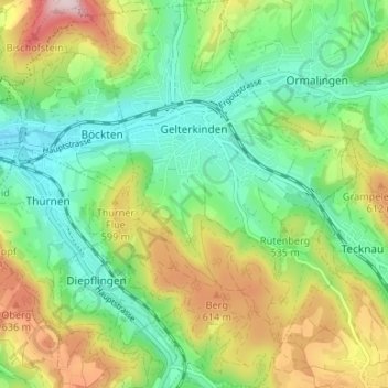
Name: Gelterkinden topographic map, elevation, terrain.
Location: Gelterkinden, Bezirk Sissach, Basel-Landschaft, 4460, Schweiz (47.43406 7.83694 47.47888 7.88318)
Average elevation: 504 m
Minimum elevation: 373 m
Maximum elevation: 741 m