
Gemeinde Fraxern topographic map
Interactive map
Click on the map to display elevation.
About this map
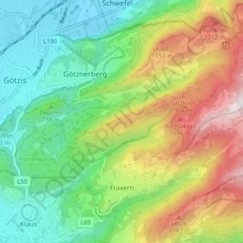
Name: Gemeinde Fraxern topographic map, elevation, terrain.
Location: Gemeinde Fraxern, Bezirk Feldkirch, Vorarlberg, Austria (47.30897 9.66232 47.34530 9.73045)
Average elevation: 1,104 m
Minimum elevation: 411 m
Maximum elevation: 1,642 m